Cycling Mt Hotham – The Cyclist’s Guide to Riding This Epic Mountain – Mt Hotham is brutal climb classically approached from the Bright side. The township of Bright is centrally located to the three iconic, and world-class cycling climbs the region has on offer. Mt Buffalo, Falls Creek and of course Mt Hotham; the toughest of them all.
You can climb Mt Hotham from the “back side” via Dinner Plain, but as there are limited accommodation options and access to the other climbs in the area so, this makes Bright the more attractive destination. The only climb considered tougher in the region is the climb back up Falls Creek from the Omeo side.
Where to Start
The township of Bright has a wide range of accommodation options and plenty of restaurants, cafes, pubs, a brewery and two supermarkets. They also have a hospital. Also, the climb from Bright is much more challenging than from the other side coming up from Dinner Plain via Omeo.
From Bright, it’s a 110 km round trip. We used to ride Mt Hotham during the Bright Training Camp that we ran several times a year until February 2020. We suggest that you pick your day, particularly if you don’t have a support car close by. Our suggestion is you don’t ride in high winds or really cold or wet days. There is little shelter and you are completely exposed to the elements the last 10 km.
The Climb
Mt Hotham is around a 30 km long climb where you’ll gain 1,279m. It has an average gradient of 4.2 percent but don’t be deceived; there are several parts of the climb the pitch up to more than 10 percent. It will take the average rider between two and three hours to ascend.
To get to the base of the climb, you’ll ride from Bright up a false flat of a 1-2% gradient for around 20 km until you reach Harrietville where you can get a coffee and have a toilet stop.
The Trip
Once you leave Harrietville, you’ll encounter a sharp bend to the left with a gradient of around 6-7% for about 800 meters then the road flattens a little as you ride through the lush alpine forest as you head up towards the first major gradient of the climb, the Meg. It’s important to take note of where it is on the climb because you’ll need to be very careful when descending through it on the way back to Harrietville.
On the descent, the gradient quickly steepens up after you have set your speed when entering the sharp right-hand corner at the bottom of the Meg. This has caught out quite a few riders out over the years, who have crashed on this corner.
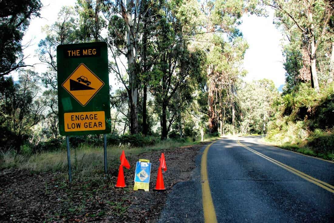
The top of the Meg – Watch for this sign when you descend and make sure that you have washed of enough speed before entering the corner at the bottom
The Meg
The Meg is around 400m at around 9%. After the Meg, it reverts to around 4-6 % for several kilometres of winding road. Then there is a false flat that’s 2-3% for 9 km that takes you to the Toll Gates at around the 19 km mark. It was once heavily forested nut fires in 2013 have opened this section of the road which now provides a stunning view of the surrounding ranges punctuated with eerie trees.
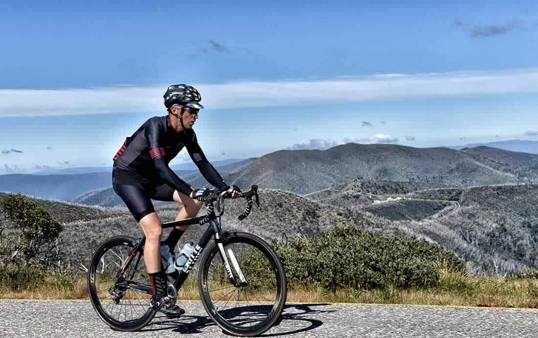
Epic 360-degree views can be found once you leave the Toll Gates
From the Toll Gates
When you leave the Toll Gates, you’ll enter the Dr Jekyll and Mr Hyde part of the climb. The gradient quickly steepens up to 7-8% for around 400-500 meters then settles into a 6% climb which breaks through into the famous moonscape views. You’ll traverse through a short flat ridge line that provides you with almost 360-degree views before you pass by a small equipment building before plummeting down to confront the iconic CRB Hill. At 1.1 km in length with a 10% gradient, it’s one of the most talked about and quoted sections of the entire climb ending at Renes Lookout.
The next major section is a little more up the road where you come around Little Baldy Hill to see another sharp 600 meter descent that leads into the last major sustained part of the climb. Looking up the road the riders above you look like little specks as the road sidles and climbs up the side of the mountain. A few km’s up the road, hidden from view is the Diamantina.
This 9%, 1.4 km section of the road is the last thing Mt Hotham will throw at you. You’ll you crest it then there is a breathtaking view to your left as you descend to the Alpine resort via the Hull Skier Bridge. When you have recovered and start your return it’s around a forty-five minute to hour long descent with some climbing thrown before you are back to Harrietville. If the wind is favourable, you’ll get a tailwind back down to Bright.
Treat with respect
Like any other mountain, Mt Hotham is to be treated with respect. The best time to climb Mt Hotham is between October and March. During winter you can quickly get hypothermic on the decent with temperatures dropping to below zero degrees when you combine the ambient temperatures with the wind chill on the bike. Mt Hotham is an Alpine resort, so it makes it very dangerous to climb due to the heavy snow traffic and treacherous snow and icy conditions during winter. But during spring, summer and autumn there is plenty of opportunities to get to the top. Be mindful though as a cold front can come through, even during summer, and drop a fair amount of snow at the top.
You’ll want to pick a day where there is a low chance of rain and the temperature above 10 degrees when you get to the top of Hotham. If it’s below 10 degrees at the top, then you’ll need booties, long-fingered gloves, arm warmers, leg warmers and a wind jacket to protect you from the cold when descending off it. If it is raining, then I would avoid it unless it’s going to be 15 degrees at the top. If the weather is not looking good, then head for Falls Creek. It’s less exposed and is not as high. I like to leave early in the morning if it’s expected to be hot on the mountain as the exposed areas towards the top can be amplified with the high altitude and reflections off the road.
Check for wind
Like any mountain this exposed, Mt Hotham can also become dangerously windy. So, when you are checking the weather take note of the expected wind speed. Anything over 35 km/h will mean that you have a higher chance of getting blown off your bike as you are caught by the gusty winds that funnel through some of the narrow passes that you’ll encounter on the climb.
As it’s an Alpine region, the weather can turn rather nasty very quickly so always check the rain radar and weather conditions before you leave. Also, make sure that you have the appropriate clothing for the descent to protect yourself from the cold. It’s not uncommon for it to be ten degrees cooler or more at the top of Mt Hotham than at Bright. So, just because it’s sunny and warm at Bright doesn’t mean that it will be anything like that at the top of Mt Hotham.
Keep visible
Finally, I recommend that you take a rear light with you. If it’s cloudy, then there may be a chance that you’ll encounter fog past the Toll Gates, or sooner. A rear light will provide a little warning to traffic coming up behind. Visibility may drop to only a few meters and if that happens then I highly recommend that you abort the accent and safely return to Bright. This is due to the heavy traffic and caravans that frequently traverse this mountain that may have difficulty stopping in time.
That being said, I’ve climbed it in all different weather, and there is nothing better than getting to the top on a warm day and looking out at the view along Feathertop as you come over the highest part of the climb before descending into the Mt Hotham village.
The Strava segment can be found here: https://www.strava.com/segments/610370
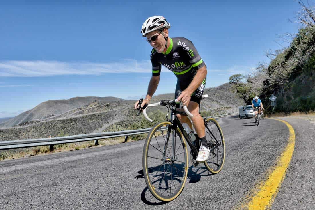
Towards the top of the icon CRB climb – 1.1 km in length with a 10% gradient

Gee willakers!!
‘The Meg’ — ugh! 😳
I swear that bugger of a climb (not helped my impatient, arrogant drivers behind wanting to pass!) registered 13% on my iGS800!!
All fine and dandy for those coming back, but really, I am aghast that riders returning think it is ok to let rip with the gas and at speed, they misjudge the approach to ‘The Meg’; it is a very fast descent. Somebody did stuff it up a couple of years ago, hurtling into the bend and whacking into the sticks! Maybe we need speed humps…:)
Conditions for my ride before Australia Day this year were fine, warming to hot (in Bright!) with a light to moderate E-SE breeze, but only 22°c at the overpass at Hotham (it did feel cooler than that, which is the wind chill). A stronger breeze coming in near CRB Hill; some riders have been buffeted heavily around (before) that point, well known for the drama in marginal windy and wet weather (riddle me this, why would you go up there when it is windy and drizzle tending to rain!?). Some people say don’t ride with 60mm deep wheels as they will act as foils for the wind (?) (my wheels are 40mm)
FLASHBACK: Forty-three years ago when I traversed the alps from Bright to Omeo, the road to Hotham was gravel: riddled with dust, corrugations and march flies (and dangerously narrower in places than today), and for a touring cyclist loaded down front and rear, battling a recalcitrant Huret Duopar derailleur, exposed to the hot sun, wind, then cold and rain, it is a painfully slow, protesting experience. Fast forrward a few decades and … rejoice! Roadies today don’t know how blessed they are: on bikes far, far removed from the heavy Reynolds 531 mules of yesteryear, with a luxurious, sealed road to the top and beyond! Best of all, there’s even a shop with Big M and Mars Bars awaiting! 👏👏
(I have downloaded the Strava segment on my ‘puter, ready for next year’s effort).